Last storm season, the SES recorded 440 storm incidents in Newcastle between September 2025 and April 2026. Spread across those eight months, that is about 55 a month, or close to two a day.
That rate is our estimate: 440 ÷ 8 months = 55, and 440 ÷ 242 days ≈ 1.8. Storms come in bursts, so no real week looks like the average. What the number tells you is that a storm call-out in this city is routine, not rare.
This season opens with a dry-sounding headline. The Bureau of Meteorology says “El Niño is at near-record levels”. Yet for October to December, the same outlook gives “roughly equal chances of above or below average rainfall” for much of eastern Australia.
On the coast, the SES says “individual coastal troughs and thunderstorms can interrupt this dry period”. When they do, they can bring large hail and flash flooding.
So does a dry El Niño mean a quiet storm season? No. At Shutters Newcastle, our advice is simple: plan for the storm, not the season.
How busy was last storm season for the SES around Newcastle?
SES storm incidents, September 2025 to April 2026
- Newcastle440
- Cessnock313
- Maitland186
Newcastle had the most of the three Hunter council areas the Herald named. The Newcastle Herald reported Cessnock 313 and Maitland 186, with more than 1200 across the Hunter. Those three council areas account for 939 of that Hunter total (our sum: 440 + 313 + 186).
Statewide, the SES responded to more than 23,000 incidents, including 18,905 storm-related last storm season. About 7,000 were fallen trees. More than 6,500 were leaking or damaged roofs.
Trees and roofs are the bulk of the work. That is why the SES's own preparation list starts with fix roof damage, clean gutters and downpipes, trim branches. Our storm season checklist guide walks through that list for a Newcastle home. This article covers the part a dry forecast hides: hail and flash flooding.
Why a dry El Niño outlook doesn't rule out storms on the coast
A seasonal outlook describes a tendency over weeks and months. A storm is one afternoon. The two can disagree without either being wrong.
The Bureau's Max Gonzalez, quoted by the SES, said the long-range forecast “shows a dry signal ... particularly west of the Great Dividing Range” at the start of spring. East of the Divide, where Newcastle sits, he described “a more variable seasonal signal”, because the Tasman Sea is warmer than average.
That warm water matters. The Bureau says warmer waters “can enhance atmospheric moisture and energy that can fuel storms and rain systems”.
The Hunter, winter to spring 2026
- Winterone of the Hunter's warmest on record
- 1 to 4 Augusta low off the coast brings 100 to 150 mm across the region
- Rest of Augustrelatively dry
- 1 OctoberBoM outlook, El Niño at near-record levels; October to December, roughly equal chances of above or below average rainfall for much of eastern Australia
The Hunter has already shown how this plays out. It had one of its warmest winters on record. Then a low off the coast between 1 and 4 August dropped 100 to 150 mm across the region, while the rest of that month stayed relatively dry.
Bureau meteorologist David Crock said the oceans “are also much warmer than usual”, adding moisture and energy to rain systems.
A strong El Niño does not guarantee strong impacts: the Bureau says a strong signal “does not necessarily mean strong impacts on Australia's rainfall and temperature; ENSO is only one of many factors”.
What makes a thunderstorm severe?
Hail, drawn to size
Wind gusts, km/h
- Severe: gusts 90 km/h or more
- Very dangerous: gusts 125 km/h or more
- Southerly buster peak gusts (a wind change, not a thunderstorm), mostly coastal, east of the Divide, warmer months
A thunderstorm is severe if it produces any one of: hail 2 cm or more, gusts 90 km/h or more, tornadoes, or heavy rain that may lead to flash flooding. Very dangerous: giant hail 5 cm or more, gusts 125 km/h or more, or intense rainfall.
The Bureau calls a thunderstorm severe if it produces any one of these:
- large hail of 2 cm or more
- wind gusts of 90 km/h or more
- tornadoes
- heavy rain that may lead to flash flooding
The next step up is "very dangerous": giant hail of 5 cm or more, gusts of 125 km/h or more, or intense rainfall.
Severe storms are the exception. The Bureau says “Most thunderstorms don't reach the intensity needed”, and most severe thunderstorms happen between September and March.
The SES's storm season runs September to April, “although major storms can happen at any time of the year”.
Newcastle also gets the southerly buster. The SES says these mostly affect coastal locations east of the Divide in the warmer months, with peak gusts around 90 to 100 km/h. A southerly buster is a wind change, not a thunderstorm, but its gusts can match the 90 km/h a storm needs to count as severe, which is worth knowing next time a cool change roars in off the coast.
Why storms and flash floods can arrive with little warning on the coast
How a flash flood forms
- too much rain, too fast, for too long
- the ground doesn't absorb all the water
- runoff into a kerb drain, a culvert and a creek
- can be several metres deep
Can occur within minutes, usually within hours, with little to no warning time
Risk is higher near creeks, drains, culverts and low-lying areas, even if you have never experienced flash flooding before.
Small differences in temperature and moisture decide whether a big storm forms. That makes exactly where and when “much harder to impossible to forecast”.
The Bureau names sea breezes and troughs among the things that lift air into storms. Both are everyday features of a coastal city. The SES adds that East Coast Lows and troughs “develop close to the coast and can intensify dramatically”, with "less lead time" for warnings.
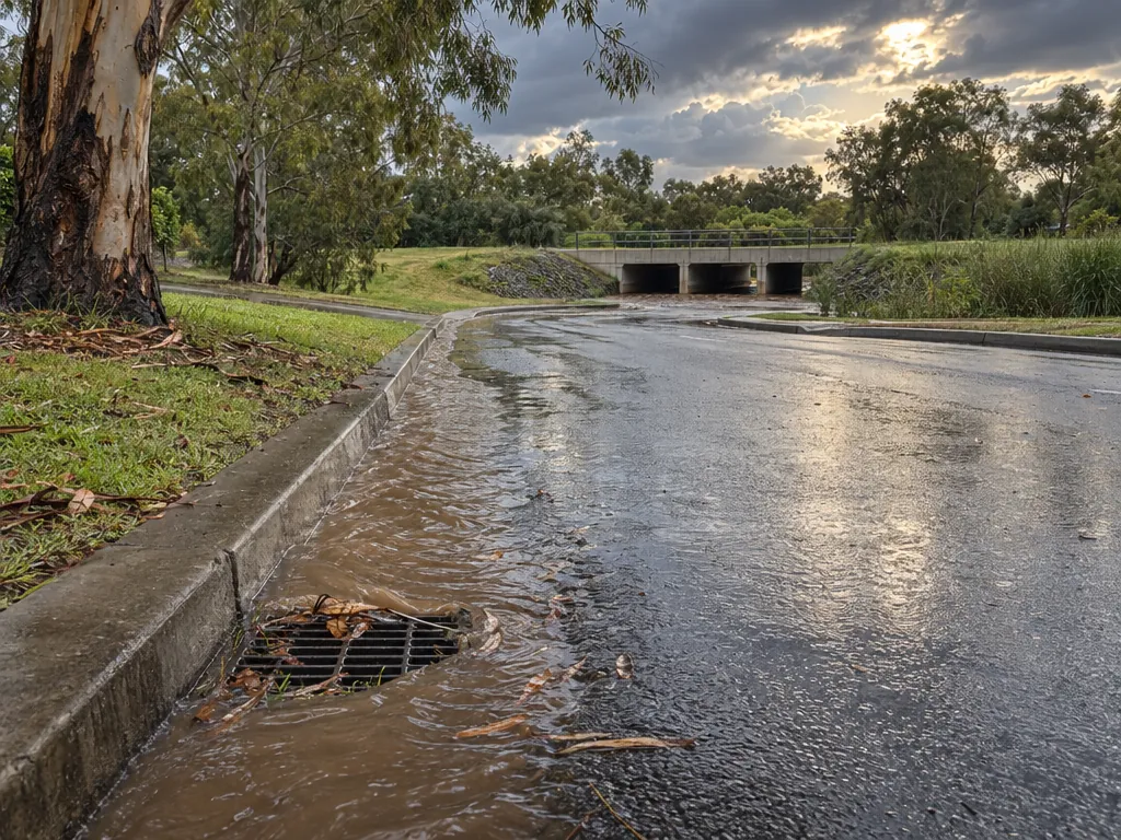
Flash flooding happens when “too much rain falls too fast for too long, and the ground doesn't absorb all the water”. It can occur within minutes, usually within hours, with "little to no warning time". Flash floods can be several metres deep.
The SES says risk is higher near creeks, drains, culverts and low-lying areas, “even if you have never experienced them before”. After a warm, dry winter, that last line deserves a second read.
How you'll hear about a storm, and when you won't
Australian Warning System
- 1Advice
- 2Watch and Act
- 3Emergency Warning
You may not always receive an official warning. Watch for:
- darkening skies
- rising wind
- thunder
For flash flooding:
- rushing or pooling water
- heavy, prolonged rain
Tornado warnings are issued inside severe thunderstorm warnings.
Warnings come through the Australian Warning System, at three levels: Advice, Watch and Act, and Emergency Warning. The SES is blunt that “You may not always receive an official warning”. Watch for darkening skies, rising wind and thunder.
For flash flooding, the SES says to watch for rushing or pooling water and heavy, prolonged rain, because an official warning may not reach you.
Tornadoes happen more often than many people realise. The Bureau records 30 to 80 observed a year in Australia. Tornado warnings come inside severe thunderstorm warnings, so don't wait for a separate tornado alert.
What the May 2023 hailstorm did in Newcastle
Share of insurance claims after the 26 May 2023 hailstorm (more than 18,000 claims by mid-June 2023)
- Vehicles77.6%
- Property21.8%
On Friday 26 May 2023, a severe hailstorm hit parts of the Hunter. The Newcastle Herald called it the worst hail event Newcastle had seen since 2006.
By mid-June 2023, the Insurance Council of Australia had reported more than 18,000 claims: 77.6% for vehicles and 21.8% for property. The worst damage ran from Merewether to Swansea.
Look at the date. Late May sits outside the September to April storm season. That is exactly what the SES means when it says major storms can happen at any time of the year.
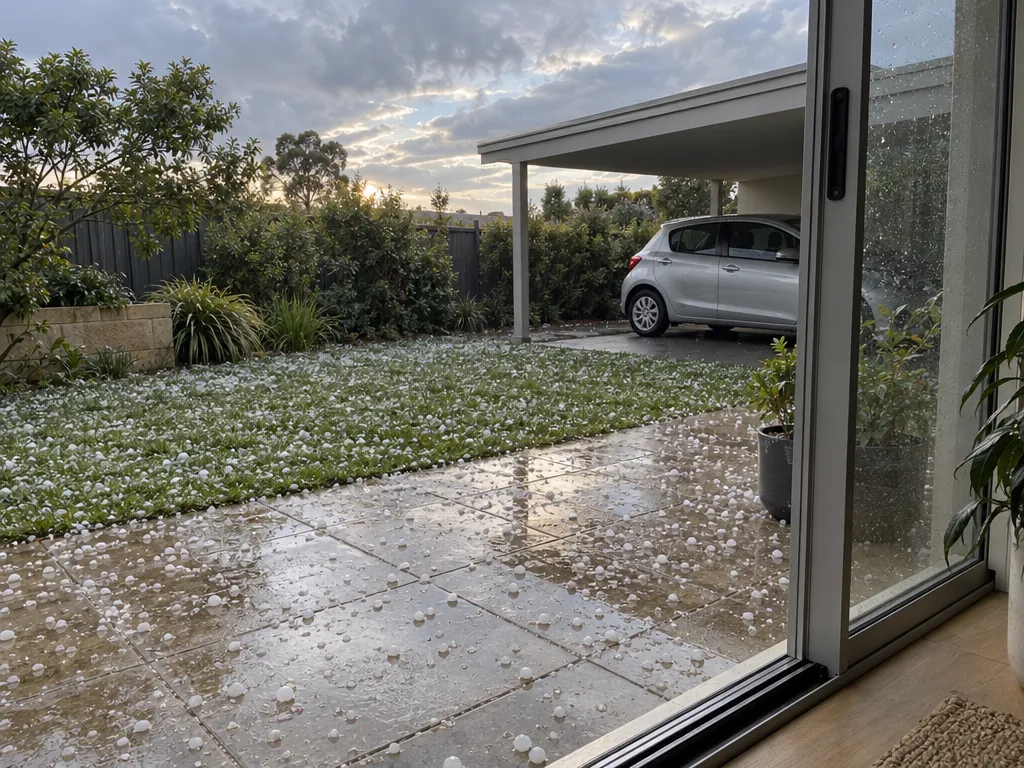
Cars took most of the claims, and the SES advice is practical. If hail is predicted, park cars undercover, or away from trees and covered with a tarpaulin or blankets.
Hail damage to windows: what the SES says to do before and during a storm
Before
During a storm
After a flash flood
The SES lists windows among the first things a severe thunderstorm can hit. It warns of “Severe damage to buildings, especially roofs, skylights and windows”.
Before a storm, the SES says: “Check that your windows and doors seal properly and get any previously broken windows repaired.” A cracked pane or a door that doesn't close cleanly is a weak point you can fix in a calm week.
During a storm, bring children and pets indoors and keep away from windows.
After a flash flood, the SES says to check the structure before entering, including damage to windows, walls and roof, and to be cautious of asbestos.
A window covering is not a substitute for any of that. Whoever you talk to about an exposed window, Shutters Newcastle included, ask what the product is rated for, if anything, and what that rating actually covers. A straight answer is worth more than a confident adjective.
What to add to your storm checklist for flash flooding and hail
Our storm season checklist guide covers gutters, branches and loose items. Add these for the hazards a dry outlook makes easy to forget:
- Know your water. Check whether your home, or the routes you drive, sit near creeks, drains, culverts and low-lying areas.
- Agree on a high place. If flash flooding traps you, the SES says to go to the highest part of a sturdy building, avoid roof cavities and call 000.
- Plan for the car. If hail is predicted, park undercover, or away from trees and covered.
- Check your policy. The SES says to make sure your insurance “is current and covers you for what you need”, including cover for the types of events specific to your location.
- Learn the three levels. Know Advice, Watch and Act and Emergency Warning, and the signs to watch for when no warning comes.
This storm season's key figures in one place
- Storm season: September to April, although major storms can happen at any time of the year.NSW SES, storm season
- Severe thunderstorm: any one of large hail 2 cm or more, gusts 90 km/h or more, tornadoes, or heavy rain that may lead to flash flooding.Bureau of Meteorology, thunderstorms
- Very dangerous: giant hail 5 cm or more, gusts 125 km/h or more, or intense rainfall.Bureau of Meteorology, thunderstorms
- Newcastle SES storm incidents, Sep 2025 to Apr 2026: 440.Newcastle Herald
- BoM, October to December: roughly equal chances of above or below average rainfall for much of eastern Australia.Bureau of Meteorology outlook
- 26 May 2023 hailstorm: more than 18,000 claims by mid-June 2023, 77.6% vehicle, 21.8% property.Newcastle Herald
Six numbers worth keeping on the fridge: the season's span and its exception, the two severity thresholds, Newcastle's 440 incidents last season, the Bureau's even rainfall odds for the east, and the scale of the May 2023 hail claims. Each comes from the sources linked above.
Talking to Shutters Newcastle about your windows this summer
Start with the SES basics: our storm season checklist guide has the full list, and the additions above cover hail and flash flooding. Do the window checks the SES asks for: seals, doors and any broken panes.
If you're weighing up window coverings for the rooms you live in this summer, talk to Shutters Newcastle. Ask us what a product is rated for, and we'll give you a plain answer. You can see what we offer or get in touch through our contact page.
Sources
- https://www.newcastleherald.com.au/story/9335964/hunter-residents-urged-to-prepare-as-ses-warns-of-el-nino-storms/
- https://www.ses.nsw.gov.au/news/el-nino-sharpens-focus-storm-preparedness-across-nsw
- https://www.bom.gov.au/climate/ahead/outlooks/archive/20261001-outlook.shtml
- https://www.newcastleherald.com.au/story/9341509/hunter-region-faces-dry-hot-spring-as-strong-el-nio-looms/
- https://www.bom.gov.au/resources/learn-and-explore/severe-weather-knowledge-centre/thunderstorms
- https://www.bom.gov.au/news-and-media/severe-thunderstorms-what-you-need-to-know
- https://www.ses.nsw.gov.au/plan-and-prepare/storm/storm-types
- https://www.ses.nsw.gov.au/flash-flooding
- https://www.ses.nsw.gov.au/stormseason
- https://www.ses.nsw.gov.au/plan-and-prepare/prepare-your-home
- https://www.newcastleherald.com.au/story/8236576/insurers-flooded-with-thousands-of-claims-after-severe-hail-storm/